GEOTECHNICAL ENGINEERING
WICHITA
HomeUnderground ExcavationsGeotechnical design of deep excavations

Geotechnical Design for Deep Excavations in Wichita: Shoring That Holds

Rigorous testing. Clear reporting.

LEARN MORE

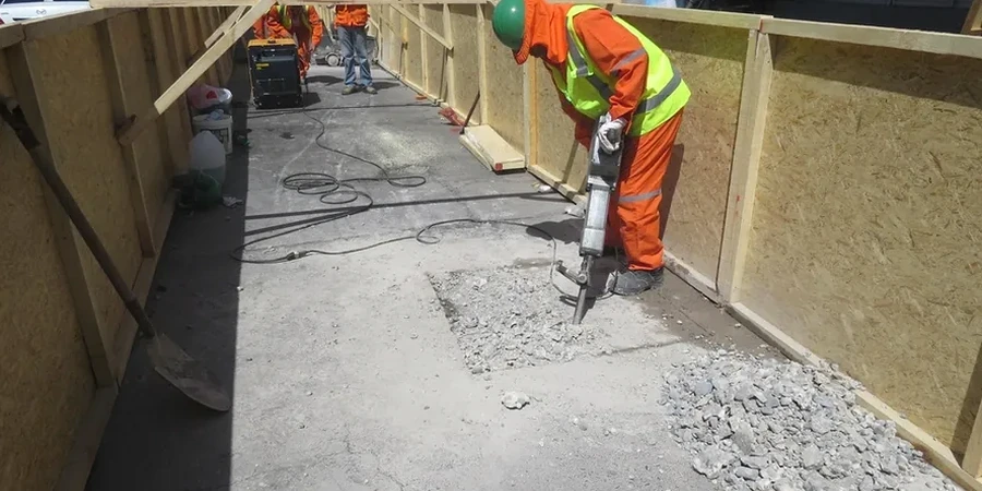
A common mistake in Wichita is treating a 25-foot excavation like a deeper basement in Kansas City. The local Wellington Formation shale looks competent on the auger, but it slakes fast when exposed to air and summer humidity. We have seen contractor-designed cuts lose face stability within 48 hours of a rain event, even when the initial slope looked dry. Our geotechnical team designs support systems specifically for Wichita subsurface conditions, combining test pits for visual logging of fracture spacing with triaxial testing to measure real drained strength parameters. Every design goes through a constructability review with the shoring contractor before the permit set leaves our office. The Arkansas River alluvium on the west side adds another layer of complexity: sand layers under artesian pressure that can blow into the excavation if wall toe penetration is too shallow. We design for that scenario from day one.

In Wichita's Wellington shale, an unsupported vertical cut can lose 40% of its shear strength within 72 hours of exposure. Design must account for that timeline.

Our service areas

Our approach and scope

A 4-level parking garage near the Delano District required a 32-foot cut next to an occupied brick building from the 1920s. The owner's structural engineer assumed a soldier pile wall with timber lagging would be enough, but our CPT soundings showed a 4-foot seam of loose silty sand at elevation 1,265 that would ravel behind the lagging the moment groundwater pumping started. We switched the design to a secant pile wall with a jet-grouted base plug, eliminating the need for dewatering and cutting predicted lateral movement from 1.2 inches to under 0.3 inches. That kind of adaptation is what separates a generic shoring section from a design that actually works in Wichita. We also integrate slope stability analysis for the construction-phase bench cuts when the contractor needs to stage the dig in two lifts, ensuring global stability isn't compromised by equipment surcharge at the top of the slope.
Geotechnical Design for Deep Excavations in Wichita: Shoring That Holds
Technical reference — Wichita

Local considerations

Wichita's weather swings hard: a dry August with 100-degree heat bakes the surface clay into hard crust, then a September thunderstorm drops 3 inches in an afternoon. An excavation wall designed for the dry condition can become unstable in the wet condition if the designer didn't run both scenarios. The expansive nature of the local soils adds another failure mode: the top 8 to 15 feet of the profile swells when wetted, pushing on the upper bracing with pressures the structural engineer never anticipated. We run drained and undrained analyses for each bracing level, and we specify a 15-foot minimum standoff for any surcharge stockpile unless the wall is designed for it. In the downtown Wichita area, proximity to neighboring basements and utility tunnels makes excavation-induced settlement a legal risk. A proper monitoring plan with pre-construction condition surveys is not optional; it is the document that protects the owner when the adjacent property owner files a claim.

Need a geotechnical assessment?

Reply within 24h.

Email: [email protected]

Video overview

Reference standards

IBC 2021 Chapter 18 – Soils and Foundations, ASCE 7-22 Section 12.13 – Earth Retaining Structures, ASTM D1586 – Standard Penetration Test (SPT) for subsurface data input, FHWA Geotechnical Engineering Circular No. 4 – Ground Anchors and Anchored Systems, FHWA Geotechnical Engineering Circular No. 2 – Earth Retaining Structures

Typical values

ParameterTypical value
Design standardIBC Chapter 18, ASCE 7-22 Section 12.13
Minimum wall embedment below subgradePer limit equilibrium analysis, typically H/3 to H/2
Typical design excavation depth15 to 45 feet for urban Wichita sites
Groundwater control methodDeep wells, wellpoints, or base plug per hydrogeologic model
Lateral earth pressure modelApparent earth pressure diagrams (FHWA) for multi-level bracing
Monitoring during constructionInclinometers, optical survey points, vibration monitors
Shoring system options evaluatedSheet pile, soldier pile & lagging, secant pile, soil nail, diaphragm wall

Frequently asked questions

How much does a deep excavation design for a Wichita project typically cost?

Geotechnical design fees for deep excavations in Wichita range from US$2,190 for a straightforward single-level basement shoring plan to US$8,690 for a complex multi-level excavation with tieback anchors, dewatering design, and finite element modeling. The scope includes calculations, signed and sealed drawings, and up to two rounds of plan check response. Site-specific subsurface investigation costs are separate and depend on boring depth and quantity.

How long does the design process take for a shoring system?

A typical shoring design for a Wichita project takes 10 to 15 business days after we receive the complete geotechnical report, structural loading information, and site survey. Complex projects with secant pile walls or soil-structure interaction modeling may require 3 to 4 weeks. We coordinate the submittal directly with the City of Wichita building department reviewer to address comments efficiently.

What subsurface information do you need before starting the design?

We need a geotechnical investigation report with borings extending at least 1.5 times the planned excavation depth below the deepest cut. The report must include SPT N-values, Atterberg limits, unconfined compressive strength for shale units, and groundwater level measurements from multiple seasons if possible. CPT data is valuable for identifying thin sand seams in the alluvium. If the existing report is insufficient, we can scope a supplemental investigation using SPT drilling and laboratory testing before design begins.

Location and service area

We serve projects in Wichita and surrounding areas.

View larger map