GEOTECHNICAL ENGINEERING
WICHITA
HomeSlopes & WallsSlope stability analysis

Slope Stability Analysis in Wichita, KS — Geotechnical Risk Assessment for Cut and Fill Slopes

Rigorous testing. Clear reporting.

LEARN MORE

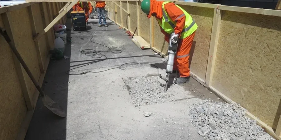
Drive east from downtown toward the Arkansas River and you'll hit dense, overconsolidated clays that hold a cut pretty well—until a wet spring hits. Compare that with the sandy silts you see out west toward Maize Road, where a 2:1 slope can start sloughing after just a couple of heavy rain days. We run into both scenarios constantly. A slope stability analysis in Wichita has to account for that variability, and honestly, you can't just copy-paste a model from another region. Permian-age shale bedrock sits shallow in parts of town, but the weathered mantle above it behaves differently depending on drainage and how much the formation has been disturbed. For commercial pads or detention basins, we'll often pair the analysis with test pits to map those weathered transition zones before we even touch a limit equilibrium model.

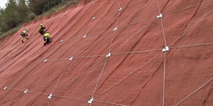
Residual shear strength governs long-term slope stability in Wichita's clay shale formations—peak values only apply if you can guarantee the slope never moves.

Our service areas

Our approach and scope

The Wellington Formation underlies much of Wichita, and its clay shale members are notorious for losing shear strength when moisture content rises above the plastic limit. In a standard year, we get around 34 inches of precipitation, but what really matters for slope stability analysis is the intensity—spring thunderstorms can dump 2 inches in an hour. So when we set up a model, we're never just pulling generic parameters from a textbook; we run drained and undrained scenarios using local peak and residual strength values from our own triaxial and direct shear tests. Often we combine that with grain size data to understand if silt lenses within the clay could act as preferential seepage paths.
We also look carefully at setbacks near the Arkansas River levee system—any excavation within influence zones requires a stability analysis that proves no adverse impact on flood control infrastructure. We run Spencer's method or Morgenstern-Price for non-circular surfaces when the stratigraphy gets complicated, which is pretty much the norm in the Gypsum Hills transition zone just southwest of the city. On deeper cuts, integrating a seismic refraction survey helps us nail down the bedrock profile and avoid underestimating the driving mass.
Slope Stability Analysis in Wichita, KS — Geotechnical Risk Assessment for Cut and Fill Slopes
Technical reference — Wichita

Local considerations

The most common mistake we see? A contractor assumes the Wellington shale will stand vertical through a rainy winter, just because it looked solid in August. Then February comes, the moisture front advances, and a wedge drops onto the access road. Wichita's freeze-thaw cycles don't help either—they fracture the top few inches of exposed clay and let water penetrate deeper during the next rain event. A proper slope stability analysis catches that seasonal degradation before it turns into a repair bill. We've also reviewed designs where the engineer used peak friction angles from a single boring and ignored the slickensided surfaces that are everywhere in this formation. Residual strength parameters aren't optional here—they're what controls long-term safety. For sites near flood control channels or the Big Ditch, we also check rapid drawdown conditions, because a sudden drop in water level after a storm can trigger slope failures that a steady-state analysis would completely miss.

Need a geotechnical assessment?

Reply within 24h.

Email: [email protected]

Reference standards

IBC 2021 (adopted by City of Wichita and Sedgwick County), ASCE 7-22 Minimum Design Loads and Associated Criteria for Buildings and Other Structures, ASTM D1586 (Standard Test Method for Standard Penetration Test — SPT), ASTM D2487 (Standard Practice for Classification of Soils for Engineering Purposes — USCS), ASTM D6467 (Torsional Ring Shear Test for Residual Strength), FHWA-NHI-05-123 Soil Slope and Embankment Design (U.S. DOT guidance)

Typical values

ParameterTypical value
Analysis methodsLEM (Spencer, Morgenstern-Price) and FEM (SSR)
Seismic coefficient (kh)Per IBC 2021 Seismic Design Category A/B for Sedgwick County
Minimum FoS (static)1.5 for permanent slopes, per IBC 2021 and local jurisdiction requirements
Minimum FoS (pseudo-static)1.1 for design earthquake, per ASCE 7-22 guidance
Groundwater modelingSteady-state and transient seepage (phreatic surface from monitoring wells or piezometers)
Soil parameters inputEffective stress (c', φ') from CU triaxial; residual (φr) from ring shear on Wellington shale
Typical slope geometries analyzedEmbankments up to 40 ft, cut slopes in shale up to 25 ft, detention pond side slopes 3:1 to 4:1

Frequently asked questions

What safety factor does the City of Wichita require for permanent slopes?

The local jurisdiction follows IBC 2021, which typically requires a minimum factor of safety of 1.5 for permanent static conditions. For seismic pseudo-static analysis, a minimum of 1.1 is standard per ASCE 7-22 guidance. We coordinate directly with city reviewers on projects where the slope interacts with public right-of-way or flood control infrastructure.

How much does a slope stability analysis cost for a typical Wichita commercial site?

For a standard commercial lot or detention basin in the Wichita area, a slope stability analysis typically falls between US$1,280 and US$4,440, depending on the number of cross-sections, complexity of the stratigraphy, and whether we need to run transient seepage or rapid drawdown scenarios. A proposal is always based on the specific geometry and available geotechnical data.

How do you handle the Wellington Formation's slickensides in the analysis?

Slickensided surfaces in the Wellington shale are a critical failure plane risk. We specifically test for residual shear strength using ring shear devices (ASTM D6467) because the peak strength is irrelevant once a pre-existing shear surface exists. Our models assign residual parameters along any mapped or inferred slickenside planes, and we run sensitivity analyses to confirm the factor of safety doesn't drop below the required threshold.

What triggers a seismic slope stability analysis in Wichita?

Wichita sits in Seismic Design Category A or B depending on site class, so pseudo-static analysis isn't always mandated for low-risk sites. However, any slope adjacent to essential facilities, hospitals, or emergency response routes typically requires seismic evaluation. We apply the design earthquake horizontal acceleration per ASCE 7-22 maps for Sedgwick County, and run a pseudo-static analysis with 50% of the peak ground acceleration as the horizontal coefficient.

Location and service area

We serve projects in Wichita and surrounding areas.

View larger map