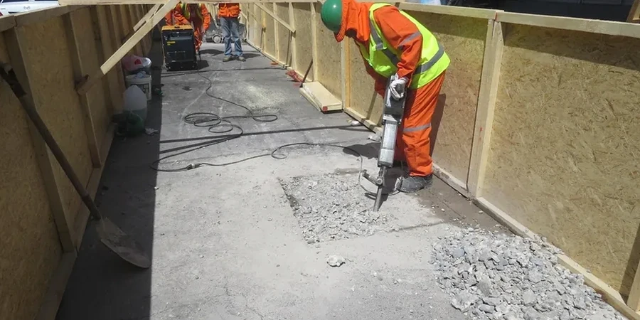
The biggest mistake we see with new construction in Wichita is assuming the soil profile matches what the county soil survey says. The Wellington Formation underlies much of the city, but its weathering profile can shift from stiff shale to fat clay within a single lot. We have pulled exploratory test pits on the west side near the Arkansas River where the top three feet looked like textbook lean clay, only to hit saturated, highly plastic material at four feet that would have wrecked a conventional footing design. When the IBC requires 3,000 psf presumptive bearing but the actual material delivers half that, the schedule and budget blow up. A properly logged test pit lets the geotechnical engineer see the stratigraphy with their own eyes, take undisturbed block samples, and run pocket penetrometer readings right at the excavation face. That direct observation is something no drill rig can replicate, and in a city where the water table can sit just six to eight feet down in the alluvial corridor, seeing groundwater seepage in real time changes the foundation recommendation entirely. We work with local excavator operators who know how to bench safely in the tight access conditions common in older Wichita neighborhoods like Riverside and College Hill.
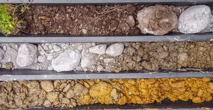
Direct visual logging of a test pit wall in Wichita's alluvial corridor reveals cross-bedding and perched water that no disturbed sample can capture.